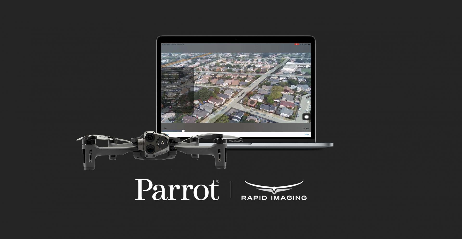
Parrot, the leading European drone group, announced today its partnership with Rapid Imaging, a technology provider delivering geospatial augmented reality (AR) and situational awareness solutions to government and enterprise users. ANAFI USA and other ANAFI platform drone users will now have access to Rapid Imaging’s SmartCam3D® SDK, allowing them to interact with live drone video in the same ways they would with a map display, such as dropping a pin to mark a location or geocoding a selection from the real-time video stream.
Parrot continues to expand its global ecosystem of drone software providers through its SDK Partner Program, offering specialized and unique solutions for the growing and evolving needs of its enterprise and professional users.
SmartCam3D overlays valuable geospatial data such as Street Vectors, Road Names, Points of Interest, Polygons, and other pertinent map entities onto real-time, full-motion-video (FMV) provided by the ANAFI USA’s powerful 4K HDR video, 32x zoom, and live video streaming capabilities – providing mission personnel with advanced situational awareness as they perform critical drone operations. These powerful situational awareness capabilities present opportunities across a variety of mission-sets ranging from airborne law enforcement, insurance, and industrial inspections to natural disaster response, real estate, and search and rescue operations.
All data captured through SmartCam3D during sensitive missions is secure, as Parrot drone users must opt-in to share flight data with Parrot’s secure to store footage. Parrot ANAFI USA also features Secure Digital (SD) card encryption, which ensures complete protection of photos and videos if the drone or the SD card is lost.
ANAFI users will find SmartCam3D easy-to-integrate, providing a turn-key solution with features including:
- Geospatial AR, allowing users to enjoy a “Google Maps-like” experience but with live drone video as the background layer as opposed to a satellite image
- Granular declutter options, allowing users to select the types of map entities displayed on their live video feed
- Custom GIS data integration, allowing users to import their own geospatial data to display
- Pin-Dropping, allowing users to mark locations within the live video with AR annotations and communicate those locations to a map display
- Forward- and reverse-geocoding, allowing professional drone pilots to designate a point in the video and immediately receive the geospatial data associated with that point (e.g., Lat/Long or Address) or designate a location (i.e., Lat/Long or Address) and mark the location with an AR annotation within the video display
- Cross-Cuing, allowing end-users to simultaneously navigate a full-motion-video display and map display
Quelle: